


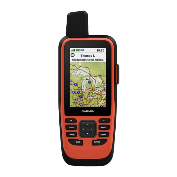
Gpsmap 86I
Sync with compatible Garmin chartplotters and instruments to see real-time boat data displayed right on your handheld. Get convenient remote operation of select onboard Fusion marine products. When you're underway, an adjustable GPS filter smooths speed and heading indications as you pass over swells for more accurate tracking. See worldwide shaded relief coverage, including oceans, seas, major lakes and rivers. And see international and state political boundaries and time zone information. Add optional BlueChart g3 coastal charts give you leading-edge coverage, clarity and detail with integrated Garmin and Navionics data.
Couldn't load pickup availability
Pickup available at Union Square Store
Usually ready in 2 hoursPairs well with
Orders placed by 2:00 PM EST Ship same-day.
Orders going to NYC deliver next day for free!
GGPSMAP 86INREACH | ORANGE
If you have any questions, you are always welcome to contact us. We'll get back to you as soon as possible, within 24 hours on weekdays.
-
Shipping Information
Use this text to answer questions in as much detail as possible for your customers.
-
Customer Support
Use this text to answer questions in as much detail as possible for your customers.
-
FAQ’s
Use this text to answer questions in as much detail as possible for your customers.
-
Contact Us
Use this text to answer questions in as much detail as possible for your customers.
Product Details
Description
Sync with compatible Garmin chartplotters and instruments to see real-time boat data displayed right on your handheld. Get convenient remote operation of select onboard Fusion marine products. When you're underway, an adjustable GPS filter smooths speed and heading indications as you pass over swells for more accurate tracking. See worldwide shaded relief coverage, including oceans, seas, major lakes and rivers. And see international and state political boundaries and time zone information. Add optional BlueChart g3 coastal charts give you leading-edge coverage, clarity and detail with integrated Garmin and Navionics data.